Local enterprise partnership proposals announced

56 proposals for local enterprise partnerships across the country have been submitted, the government has confirmed, following the closing day for submissions.

There are seven proposals from the West Midlands:

Three distinct responses in respect to cross boundary working arrangements have also been received from Peak District, South East England and West Leicestershire and Northern Warwickshire.

Here’s the full list of proposals.

Speed dating: bringing the Regional Data & Intelligence Network together

Attendees at all-group networking eventLast Friday, for the first time in its history, we brought together all the groups associated with the Regional Data and Intelligence Network. Members of the Economy & Labour Force, Population & Society, Environment and Geographical Information groups met, with the aim of drawing the network closer together and identifying common areas of work.

Continue reading

Interactive maps – beyond election results

Media coverage of yesterday’s general elections has included many interactive online maps. Voters have been able to explore the election votes in different ways, seeing who won what where, and how close the contests were.

Here at the Observatory, we use InstantAtlas software to produce this kind of map. We’ve produced a map of yesterday’s election results as an example, but in fact we have many other maps available covering a wide range of topics. For example, Jobseeker’s Allowance claims by ward or the results of the place survey, which asked residents how they felt about their local government.

Looking at these kinds of data geographically can often be illuminating; maps can often reveal patterns that the raw data alone wouldn’t reveal. At the Observatory, the spatial dimension is something we’re always considering – maps aren’t just for election time!

Open data in Warwickshire

Warwickshire County CouncilGuest blog post by Jim Morton, Applications Architect at Warwickshire County Council

Last week we launched the Warwickshire Open Data site at http://opendata.warwickshire.gov.uk, joining other authorities such as London, Lincoln, Lichfield and Kent who have already started opening up their data to the public.

We hope that it will provide a greater level of transparency about the work of the council, as well as stimulating the development of websites and applications that can make use of our data, to provide new benefits to our citizens and visitors to the area.

It is going to take a while to build the site up as the focal point for all of our public facing information but we have taken some positive steps to build the foundations of how we should work with data from now on.

Continue reading

New report sheds more light on West Midlands geography

In the public sector, many of our policies, strategies and services follow administrative boundaries such as regions, local authorities, police force areas, primary care trusts or even wards.

But out there in the real world, people don’t live their lives as neatly as that. Many people live in one place and work, learn or shop in others. Businesses too have customers and suppliers from many different places.

Whilst every person, and every business is different, understanding the patterns in these kinds of links between places is important.

For example, when analysing the local labour market it is no good just looking at the people who live locally if many local workers come from elsewhere.

Understanding “functional geographies” has always been important but the issue’s profile has been raised in recent times as government has sought to devolve more responsibility for economic development to sub-regional and local areas.

Over the next year all upper tier and unitary local authorities will need to produce Local Economic Assessments. Government guidance says that these will need to “identify the economic linkages within the area assessed and between it and the wider economy.”

In preparation for this, the Observatory has just published a report looking at some of the key sub-regional links between places in the West Midlands.

Continue reading

Regional Skills Assessment published

The Regional Skills Assessment for 2009 is now available. This extensive research gives an overview of the changing needs of the West Midlands’ labour market, along with a detailed exploration of key issues by sector, by sub-region and for key groups.

This year’s main report presents a few distinctive sections compared to previous years. It mainly focuses on recent trends, looking also at the impact of recession and prospects for recovery.

The main report is complemented by two reports identifying the main skills needs and issues in each of the region’s key sectors and clusters.

The Assessment also includes a series of six detailed sub-​regional skills profiles assessing recent trends and future prospects for both the demand for and supply of skills. The profiles highlight key issues to support, in particular, development of Local Economic Assessments by local authorities, the commissioning of 16-​19 learning provision and the work of sub-​regional Employment and Skills Boards. The sub-regional assessments cover:

  • Birmingham and Solihull
  • Black Country
  • Coventry and Warwickshire
  • Herefordshire and Worcestershire
  • Shropshire
  • Staffordshire

In addition, there’s an entire chapter dedicated to future prospects in the region’s labour market with forecasts covering both short-​medium term (2009 to 2014) and long term (to 2024), using the Observatory’s economic forecasting model.

View the Regional Skills Assessment 2009 pages on wmro.org

Key contact: Andy Phillips, Head of Skills Research

2011 Census Output Geography Consultation

Office for National StatisticsThe Office for National Statistics (ONS) are holding a consultation on the 2011 Census Output Geography policy.

Dr Ray Perrins from the South West Observatory has volunteered to respond on behalf of the Association of Regional Observatories.

There are three main topics:

  1. A new geography for improved reporting of business statistics and statistics relating to the workplace
  2. An upper layer of Super Output Areas (USOAs)
  3. A request for exceptional instances of current Output Areas and Super Output Areas, as designed for 2001, that do not fit present criteria for statistical zones

However, the consultation also provides an opportunity for you to comment on any aspect of the current 2011 Census Output Geography policy.

If you’re involved in the Regional Observatories and would like anything to be included in any response from the Association of Regional Observatories, please contact Dr Ray Perrins at the South West Observatory. Please get responses to Ray by Monday, 22nd March 2010.

However, the consultation is open to everyone, including members of the public. ONS suggest on their site that:

Government departments, unitary, county and district councils, metropolitan boroughs and other large census user organisations should discuss their requirements internally before making a joint submission.

How to make a submission and contact details are available on the ONS consultation page.

Consultation on making Ordnance Survey mapping data freely available

Person from Ordnance Survey submitting geographic data on a handheld computer

Ian Austin, Regional Minister for the West Midlands and Communities Minister, outlined proposals at the end of December 2009 on how to make Ordnance  Survey mapping data freely available, so that the data can be re-used in innovative applications and products.

Communities and Local Government launched a consultation on 23 December 2009, Policy options for geographic information from Ordnance Survey, on which Ordnance Survey datasets can be made freely available to support digital innovation and democratic accountability.

You can view the consultation PDF here or use this online form to tell the government what you think.

The deadline for consultation responses is 17 March 2010.

OS data is used heavily here in the Observatory and by partner organisations. It’d be interesting to hear what you think and the issues you’re feeding back in the consultation. Do let us know in the comments.

Observatory map featured in top 10 government data visualisations and applications

An interactive map produced by the Observatory has been featured in The Guardian’s top 10 government data visualisations and applications.

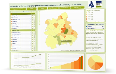
Screenshot: interactive map showing Jobseeker's Allowance claimant rates in the West Midlands

This map shows the proportion of the working age population claiming Jobseeker’s Allowance in each local authority in the West Midlands. You can also compare data for each local authority with the West Midlands and UK averages.

The map is based on the latest employment and unemployment data released monthly by the Office for National Statistics. The Observatory analyses this data as part of its work in monitoring the impact of the recession on the West Midlands.

As well as local authority, we also show the data in maps for:

The 10 data visualisations and applications were highlighted by the Guardian Datastore on the same day the government publicly launched the data.gov.uk site. This new site aims to unlock innovation and encourage data-led decisions by opening up public sector data for reuse in innovative applications and websites.

Continue reading

An introduction to geographic information and why it’s important

Brian Higgs from Dudley Metropolitan Borough Council gave a presentation about the importance of geographical information (GI) at the Geographical Information Day, hosted by the Observatory on 18th November 2009.

Brian introduced the concept of geographical information and demonstrated practical examples of how GI is used within Dudley MBC. Here’s Brian’s presentation which includes the audio and slides:

Can’t see the presentation? View the video on Viddler.com or get the PowerPoint slides (ppt, 12.7mb).

GIS mapping supports local “My Health Matters” project in Stoke-on-Trent

This guest post was contributed by Graham Smith of Staffordshire University.

The My Health Matters project has been designed specifically to help build partnership with statutory healthcare providers, the local voluntary and community sector to help meet the challenge of increasing physical activity levels and healthy eating in targeted areas within Stoke-on-Trent.

The project is based on evidence that increasing levels of physical activity and healthy eating will help to raise the low levels of life expectancy experienced by the population of Stoke-on-Trent.

This project is funded by NHS Stoke-on-Trent Primary Care Trust. The project will focus on areas within three deprived wards in Stoke-on-Trent:

  • Burslem South
  • Weston & Meir North
  • Bentilee & Townsend

Each ward is similar with regards to socio-economic status (i.e. in the bottom 40% of the Indices of Multiple Deprivation 2007).

Continue reading

GIS used to digitise brownfield land sites and inform planning in the Black Country

This guest post was contributed by Christopher Styche from the Black Country Observatory.

Geographical Information Systems (GIS) were used as a tool for analysis in a project looking at brownfield land across the Black Country during the end of 2006–2007.

The purpose of the project was to inform policy makers involved with the implementation plans for the Black Country and emerging core strategy.

There was a strong partnership approach to this work with representatives from all four local authorities (Dudley, Sandwell, Walsall and Wolverhampton), as well as the Homes and Community Agency and Advantage West Midlands.

This post describes the project step-by-step and the role of GIS within the project.

Continue reading

Making the invisible visible: matching West Midlands ICT SMEs with business opportunities

West Midlands ICT Cluster AWMistThis is a guest post written by Brian Prangle with contributions from Andrew Mackenzie.

West Midlands Regional Development Agency, Advantage West  Midlands (AWM) has unveiled its latest initiative to stimulate and develop the high technology sector.

AWMist (A Web Map-based Information Search Tool) is the first regional interface of its kind where collaboration, business opportunity building, and partnerships can be easily forged between the region’s ICT SMEs (Small to Medium Enterprises) and those who can support and assist them, such as funding agencies, universities and business support projects.

Continue reading

Securing a healthy natural environment for today and the future

The most recent meeting of the Observatory’s Environment topic group reviewed evidence to “Identify Regional Natural Environmental Priorities for the West Midlands”. Evidence highlighted by the group will inform work by the region’s Defra Agenda Group (DAG) to identify regional environmental priorities. The DAG comprises Government Office for the West Midlands, the Environment Agency, Natural England, Forestry Commission, Advantage West Midlands and Animal Health.

Continue reading

Roundup of Geographical Information Day 2009

This is a roundup of the presentations given at last week’s event in Birmingham focused on the importance of geographical information and systems. The event was targeted mainly at primary school teachers, though many delegates from the public sector attended.

The event which was chaired by Shona Frost from Staffordshire County Council.

Continue reading